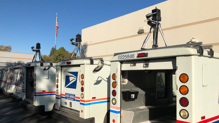
The Postal Service recently teamed with Ericsson, a leading information and communications technology provider, to collect geospatial radio spectrum data in San Francisco.
Geospatial data is used to digitally map locations for electronic navigation applications.
The Ericsson test specifically mapped radio spectra, including spectra used for location-based applications.
Three postal vehicles in San Francisco were equipped with special smartphones that captured data as they traveled along three city routes for several weeks.
Postal employees Kasey Quellette, Chao Wen and Daniel Xu drove the vehicles, while California 1 District Manager Abraham Cooper, who served as the local postmaster at the time, and Robin Stahmer, a customer services manager who recently retired, supervised the project.
“I see other [geospatial] vehicles going around San Francisco every day. So I was very excited to see us do this. It was a good partnership. We were only in the city, but we could also broaden the scope with rural carriers in rural areas,” Cooper said.
The Postal Service and Ericsson are currently reviewing the results, which could provide significant insights about broadband access and help USPS generate new revenue.
“We learned where there is an ability to connect and where there isn’t and how disparate Internet connectivity is,” said Lucinda Rockemore, a digital solutions business specialist for the Postal Service.
Deployed on a larger scale, the radio spectrum project could be beneficial to the approximately 40 million Americans who are without broadband access, which hinders internet-based communication, education and employment opportunities.
The test also highlighted how the Postal Service’s vast network of delivery routes can be used to help companies like Ericsson or government agencies conduct geospatial projects.
“While we are meeting our universal service obligation, the Postal Service can use its fleet to earn additional revenue and improve the communities that we serve,” Rockemore said.