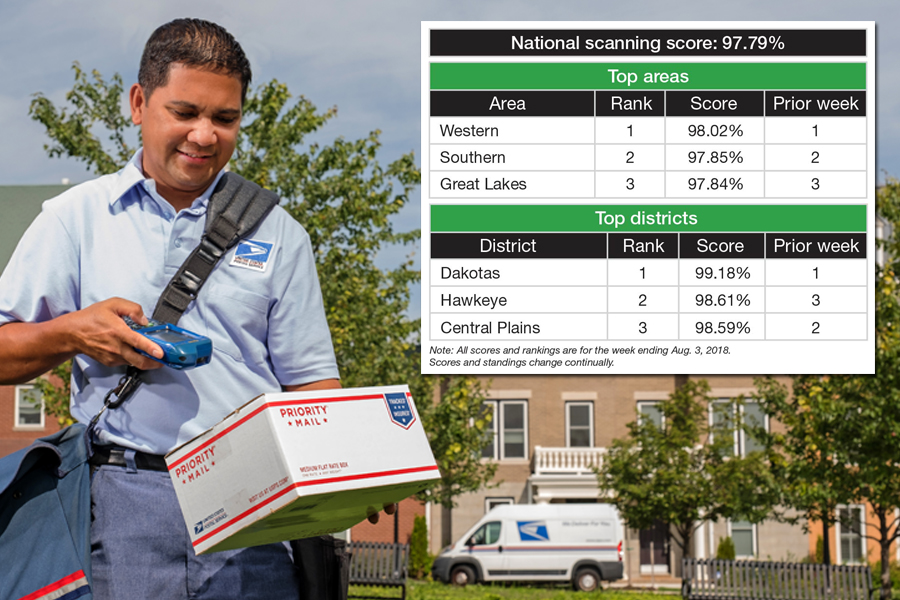
Scanning snapshot. The Postal Service’s national scanning rating was 97.79 percent during the week ending Aug. 3, down from one week earlier.
Dakotas (99.18 percent) topped the districts, while Western (98.02 percent) led the areas.
Scanning allows customers to track their packages and mail, and it helps USPS improve efficiency and network management.
To see the latest results, go to the Enterprise Analytics site and select “Analytics Tools,” followed by “DES2 Scan Dashboard.”
All over the map. Reminder: The USPS National Map is an interactive tool that allows employees to track the operational status of postal facilities.
The online map provides a visual representation of the on-ground conditions in a given area and allows managers and others to make informed operational decisions.
The map can be especially useful for sites affected by natural disasters and extreme weather, such as hurricane season, which is underway through Friday, Nov. 30.
Got news for “Need to know”? Email your submissions to uspslink@usps.gov.